Casa Real de Bucay
The First Capital of AbraCasa Real de Bucay: The First Capital of Abra
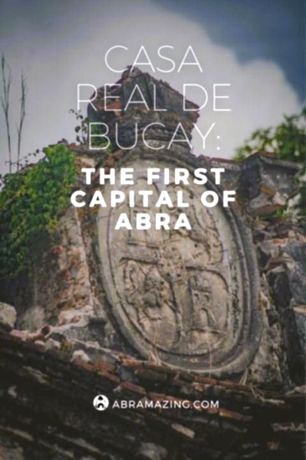
Casa Real in Bucay, as it stands today, is a grand stone arch with columns, topped with the insignia and crown of the Kingdom of Spain. Once part of a long-gone military fort built high on a cliff overlooking the Abra River, this arch was the gateway to what was once a stronghold. The fort was crucial to the creation of Abra as a province in 1846, when Bucay became its first capital. Sadly, apart from this arch and a few scattered remains, most of the fort has disappeared. The arch itself is in poor condition, especially after the 1991 earthquake, which cracked it in the middle. It could collapse with the next big typhoon or earthquake.
Casa Real is more than just an old structure. It symbolises:
- The making of Abra as an independent province in 1846;
- Bucay’s role as the first capital;
- The strategic importance of Bucay, which was a natural defence point against the Tinguians living in the nearby mountains;
- The application of 19th-century Spanish military architecture to protect the area.
A book published in 2006, titled Endangered Fil-Hispanic Architecture, highlights Casa Real as one of the Philippines’ many historical structures that are at risk of being lost due to natural disasters, neglect, or intentional destruction.
Preserving and restoring Casa Real is vital. These historical sites are not only part of the Philippines’ cultural heritage but also help us understand where we come from.
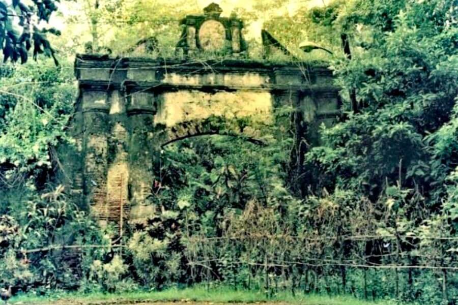
Fort General Martinez and Casa Real: The Arch and Ruins
In its prime, the fort was known as Fuerte General Martinez, a well-organised military complex. Built under Captain Don Ramon Tajonera, the first governor of Abra, it served as the provincial government centre and military base. A plan from 1848 shows the fort as a square structure, with palisades made of wood and cane, and guard towers in each corner. Today, only the stone arch, now called Casa Real, remains.
Inside the fort were the officers’ quarters, a kitchen for the troops, a tobacco warehouse, and even a sundial. Cargo transported along the river was unloaded at a platform near the warehouse, and there was even a communication system using homing pigeons, the earliest form of telecommunications in Abra.
The fort fell into ruin over time, and today, only a few structures remain, hidden beneath overgrown vegetation. In 2006, a field trip led by historian Gemma Cruz Araneta documented what little is left, which was later featured on her TV programme.
One of the more intriguing ruins is a broken brick needle, which might have been part of a sundial or flagpole. Another is a solid square platform, once used to house artillery. There are no remains of the perimeter wall, which was likely destroyed by typhoons.
Governor Tajonera intended for Casa Real to be located within the fort. While plans were made to build a separate Casa Real building, the officers’ quarters were instead adapted to serve that purpose.
Over time, the memory of the fort has faded, and the site is now home to private residences, a piggery, and wild vegetation. Locals now only remember Casa Real as the arch, forgetting its original role and historical significance. This neglect, along with the poor state of the arch, makes it essential to take immediate action to preserve this important piece of history. Steps must be taken to stop further decay, revive Bucay’s historical memory, and restore the fort to its rightful place in the town’s heritage.

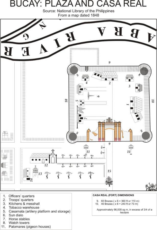
Bucay Plaza and Casa Real. Source National Library of the Philippines. From a map dated 1848.
This article was adapted from a study on the Casa Real de Bucay entitled Casa Real de Bucay, 1st Capital of Abra which can be read by clicking the link below.
The original study was made by Jose R. Perdigon in 2007 with the help of a research grant from the Spanish Program for Cultural Cooperation (SPCC.)
Finalized in July of 2007, the study is based almost exclusively on manuscripts from the National Archives of the Philippines, so far unpublished.
PIN to Read Later
Did you like “Casa Real de Bucay: The First Capital of Abra” ? If so then please share this page with your friends.
Leave a comment below to let me know what you liked best.
Follow ABRAmazing on Facebook, Instagram ,Twitter and Pinterest for more travel adventures and be notified about my latest posts and updates!
Thankyou for sharing 🙂
PIN to Read Later
Please Note – All blog post photos on Abramazing.com are of a lower quality to enable faster loading and save you data. If you would like to buy or license higher quality copies of any of the photographs you can email us at abramazing.ph@gmail.com
All photographs and content on this website remain the property of Abramazing.com. Images may not be downloaded, copied, reproduced or used in any way without prior written consent.
Print purchases entitle the purchaser to the ownership of the image but not to the copyrights of the image which still remain with Abramazing.com even after purchase.

Follow Abramazing for more Culture, Heritage, Food and Travel around Abra
Facebook @Abramazing.Ph | Instagram @Abramazing.Ph
Twitter @Abramazing | Pinterest @AbramazingPh
Affiliate Disclaimer: Links on this website may be affiliate links that could result in us receiving compensation when you purchase a product or service from that link. You do not pay any extra fees for these items. This helps us to keep this website going. Thank you for your support.
Disclaimer | Privacy Policy | All Rights Reserved


